Land Surveying Services
Our Experienced Land Surveyors Will Help Your Project Stay on Track
Our certified, professional land surveyors have the experience and knowledge to provide precise benchmarks and controls to keep your project progressing. Our services extend not only to commercial clients, but also to landowners, contractors, architects, developers, engineers, lenders, real estate firms, and title companies.
Professional Land Survey Services
We offer a multi-faceted approach to land surveying. We provide quality services and technical excellence to clients. We are licensed in Pennsylvania, Maryland, Delaware, and West Virginia.
We perform surveys with the latest in GPS, robotic total stations, scanners, LiDAR, and unmanned aerial survey (UAS) technology.
Our clients count on us to provide the accurate documentation that is required for Title Insurance and other items required in property transactions.
Construction Stakeout
Construction stakeout services make the ideas of architects and engineers a reality by correctly positioning future improvements on the ground. We use the latest software and equipment to provide dependable construction stakeout services to contractors for a wide variety of clients.
Our land surveyors’ commitment to this essential part of construction provides an expert resource you know you can rely on from beginning to end of the construction process.
Boundary Surveys for Residences
An ALTA boundary survey will tell you the property boundaries, physical features, potential encumbrances, and any easements on your property. For example, if you’re looking to add a fence to your yard, you’ll need to know the property boundary lines and if any easements exist before adding the fence.
Contact us to request a boundary survey.

A Technology-First Approach
We use the latest field-to-finish technology in data collection and total station equipment.
In the field, FCE land surveyors use Leica Robotic and GPS-enabled surveying equipment, which allows for control at all functions from the surveying point.
Survey technicians, as well as our project managers, are networked using the most current CAD software, allowing them to precisely visualize and present the data collected from the surveyed area.
Whether a survey requires data acquisition for highly accurate, land-based development or integrated Geographic Information System (GIS) mapping, we can respond using our technology .
Land surveying services we provide include:
- ALTA/Boundary Surveys
- Subdivision Surveys
- As-Built Surveys
- Easement & Route/ROW Surveys
- Inspection, Elevation, & Improvement Surveys
- Construction Stakeout
- Utility Surveys
- Legal Descriptions & Exhibits
- Topographic Surveys (aerial mapping, remote sensing, and conventional)
- Railroad Surveys
- Stream and Corridor Cross Sections
- Gradient Boundary Determination
- Design Surveys
- Control for Aerial Photogrammetry/LiDAR Surveys
- Plant Site Monumentation and Subsidence Surveys
- Geodetic Surveys
- FEMA Elevation Certificates
Land Surveying: Frequently Asked Questions
Where does FCE offer land survey services?
Our land survey services are completed in Pennsylvania, Maryland, Delaware, and West Virginia.
Which land surveying certifications & licenses does FCE hold?
What determines the cost of a property survey, shouldn’t they all be the same price?
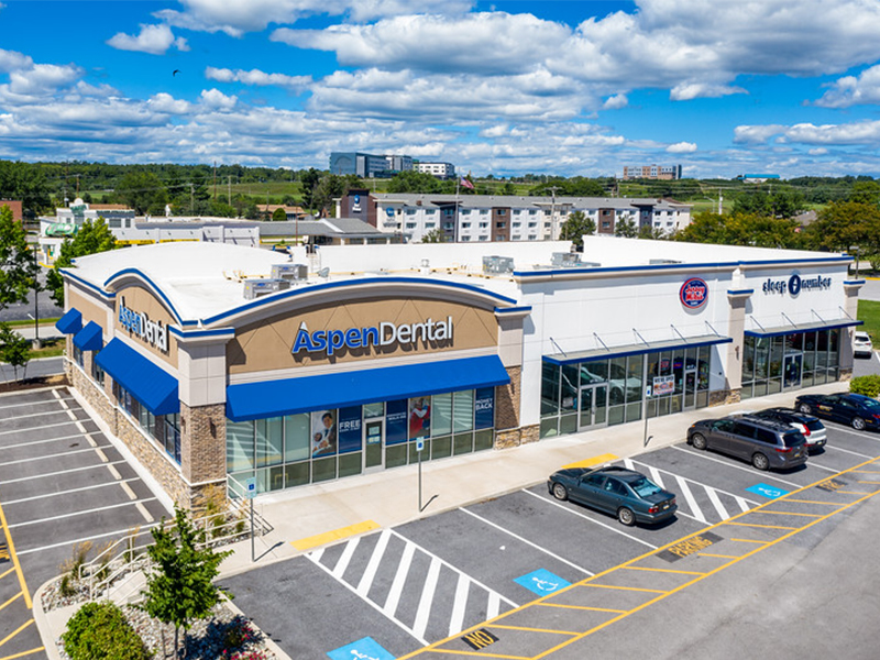
Featured Project
Retail Site Redevelopment in York, PA
This project included a boundary survey, an ALTA survey, and the preparation of a Preliminary/Final Land Development Plan for the property.
Certifications & Affiliations


Request a Consultation
How can we assist you with your next project? Call 717.845.3227 or complete the form below. We’ll get back to you within 1 business day.